The Port of Broome is situated on the northwest shore of Roebuck Bay. The Port exports mineral sands (bulk) and cattle; services fishing, pearling, cruise and charter vessels; and supports the offshore oil and gas industry.
Navigation Chart Location
Latitude: 17” 58’ South
Longitude: 122” 14’ East
There are two operational terminals in the Port, KPA Terminal 1, and KMSB Terminal 2.
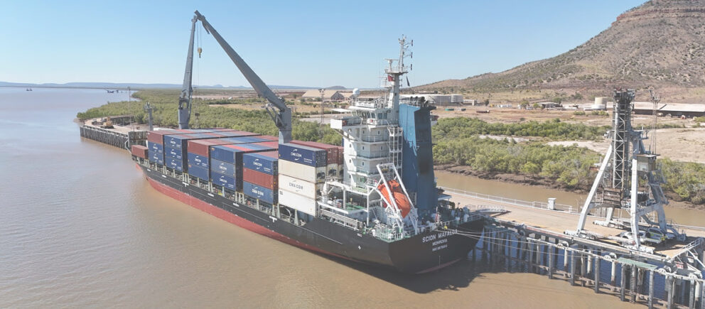
KPA Terminal 1
The wharf is a steel piled structure with a concrete deck and spring fendering. The outer berth is 331 metres long with maximum vessel displacement of 50,000 tonne. Larger heavier vessels have been berthed with the approval of the Harbour Master.
The two inner berths:
- Berths one to three are 170 metres long with maximum displacement 9,000t, and
- Berth 11 is 65 metres long with maximum displacement 1,500t.
At chart datum (Lowest Astronomical Tide (LOA)) the deck or wharf height is 13.6m from the waterline and 12.2m to the top of the fender system.
There is lighting for 24-hour operations.
The KPA Terminal Wharf Map supplies information on berth, fuel and water point locations.
Fees & Charges
The current Schedule of Fees & charges 2026/27 for the Port of Broome can be found here Schedule of Fees & Charges 2026/27
General details:
Vessels up to a LOA of 300m are accommodated at the Port, and scheduled according to the following considerations:
- Least depth in entrance of the channel is 7.2m at chart datum (based on 2024 hydrographic survey)
- Declared berth depths – Refer to latest KMA LMN.
- Tidal current in the channel.
The tidal height is about 9.4m at mean high-water springs and 6.4m at mean high-water neaps.
Port of Broome has one of the largest tidal ranges in the Kimberley. Tidal streams in the harbour approaches can reach up to 5 knots, while closer to the terminals, they may reach 3 knots.
For further information on the Port of Broome wharf and berthing procedures please go to Port Operations.
Radio Communications
Port of Broome maintains a 24-hour, 7 day watch on VHF Channels 14 and 16.
Laydown area
There is a turnaround and parking area for trucks conducting business at Port of Broome. Terms and conditions apply.
Port of Broome laydown area.
Information on Land
Access information on land here
Parking
Public car parking facilities are located between Customs House and Port of Pearls House with limited public amenities. The Entrance Point boat ramp area includes two ramps and parking for vehicles with boat trailers.
Slipway
Permission must be sought prior to using the Slipway or carrying out work in the area. Work permits are issued from the Operations department located at 549 Port Drive.
Please see the Permit to Work System information.
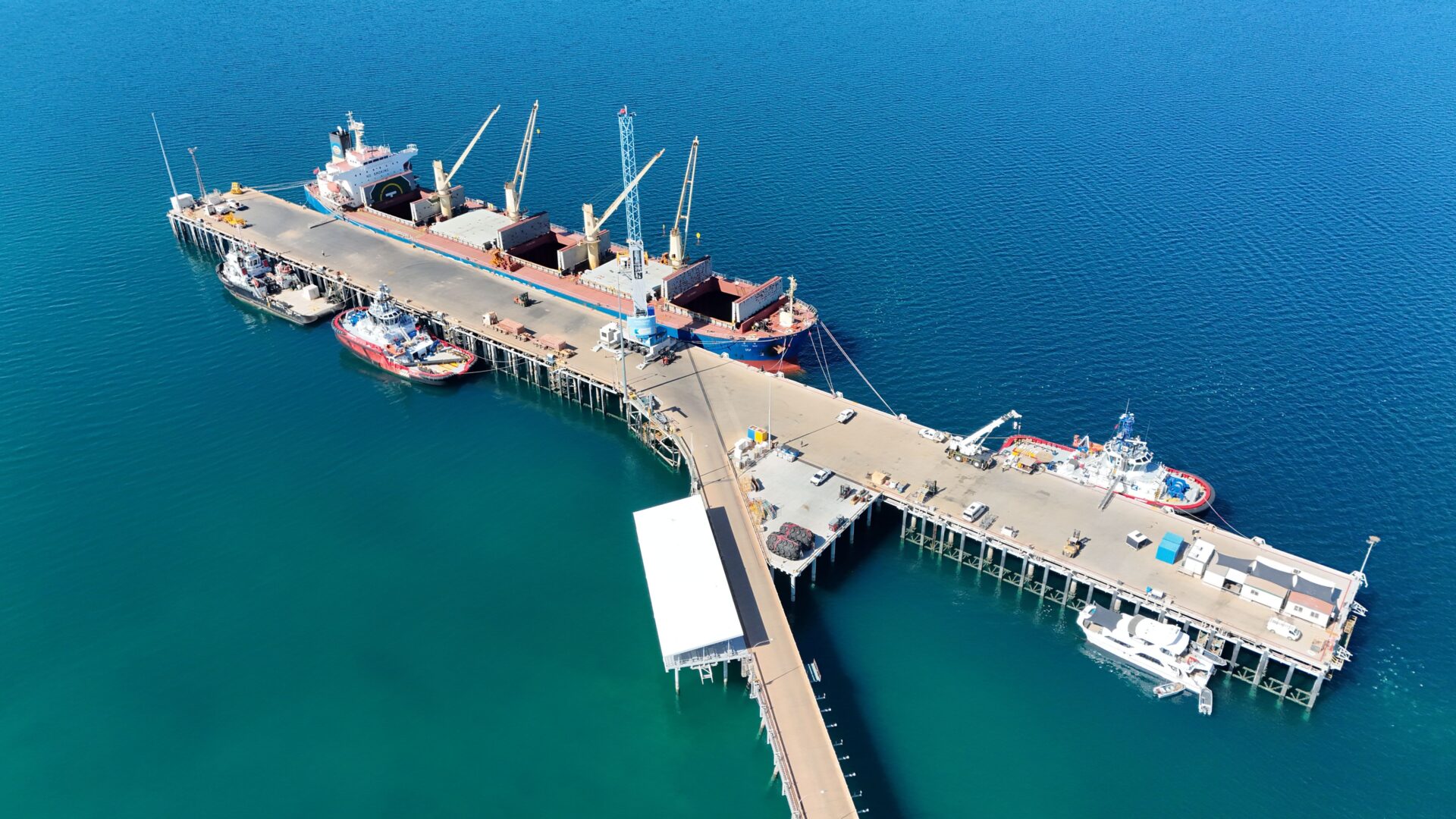
Kimberley Marine Support Base (KMSB)
The Kimberley Marine Support Base Pty Ltd’s Marine Offloading Terminal was officially opened by the Minister for Ports Stephen Dawson MLC on 12 September 2025.
The KMSB Terminal 2 along with associated onshore terminal facilities is located to the south of the Port of Broome wharf and will provide complimentary facilities for maritime trade and tourism.
Kimberley Ports Authority has worked with KMSB to redirect traffic to Entrance Point recreational area during the construction period and going forward.
There will be future road works undertaken, including the installation of a roundabout to separate port commercial from recreational traffic.
KPA is optimistic the project will stimulate development, employment opportunities and provide benefits to both Broome and the region.
For more information, please access KMSB’s website.
The KMSB terminal 2 incorporates a floating wharf linked to a fixed causeway. The main floating jetty together with 2 attached berthing dolphins are 265m long with maximum vessel displacement is 68,000 tonnes.
The 3 berths on the outer face, have a total berth pocket length of 300 metres long.
For KMSB Terminal 2 supplies information on berth, fuel and water point locations, please call KMSB on 0427 399 238.